Property boundaries play a crucial role in defining land ownership, usage rights, and development potential. Whether purchasing land, planning construction, or resolving disputes, understanding the exact limits of a property is essential. A professional land surveying company combines legal research, field measurements, and advanced technology to ensure accurate boundary identification. This process forms a key part of cadastral surveying, which focuses on establishing legal land ownership and mapping property divisions.
What Is a Boundary Survey?
A boundary survey involves the precise measurement and mapping of a property’s legal limits. It confirms the exact location of a cadastral boundary, ensuring that structures, fences, or new developments remain within approved land limits. This type of survey is commonly required when buying or selling property, subdividing land, or planning construction near shared borders. Understanding the potential boundary survey cost in advance helps property owners budget effectively and avoid unexpected delays during development.
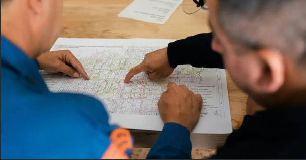
Reviewing Legal and Historical Records
The survey process usually begins with detailed research into historical and legal documentation. Surveyors review title deeds, previous survey plans, and land registry data to interpret the original legal description of the property. In many cases, older boundary markers may be missing or unclear, requiring careful analysis before fieldwork begins. Accurate record interpretation is particularly important in engineering surveying projects where infrastructure design relies on dependable boundary data.
Conducting Field Measurements
Following the research stage, surveyors carry out on-site inspections to locate physical evidence such as boundary pegs, fences, retaining walls, or natural reference points. Modern equipment including total stations and satellite positioning systems enables highly precise measurement of distances, angles, and elevations. These observations help determine whether existing site features align with documented boundaries or require further verification.
Using Advanced Surveying Technologies
Technological innovation has significantly enhanced survey accuracy and efficiency. Techniques such as a 3d laser scanning survey allow professionals to capture detailed spatial data in dense urban or complex environments. Likewise, uav surveying uses drone-based imagery to collect topographic information across large or difficult-to-access areas. These modern methods support accurate mapping and data validation, helping surveyors confirm property limits with greater confidence.
Interpreting Evidence and Preparing Survey Plans
In some situations, physical site conditions may not perfectly match legal descriptions. Surveyors must assess inconsistencies using professional judgement, applicable legislation, and consultation with neighbouring property owners when necessary. After verifying all information, a final survey plan is prepared. This document includes boundary dimensions, coordinates, easement details, and certification notes required for land registry compliance.
Why Accuracy and Professional Expertise Matter
Accurate boundary surveys help prevent construction mistakes, neighbour disputes, and regulatory complications. In Australia, licensed surveyors are known for achieving extremely high levels of precision, often within millimetres depending on terrain and available historical data. Selecting an experienced provider such as Sunrise Surveying can provide additional confidence, as established professionals combine technical knowledge with advanced equipment to deliver dependable surveying outcomes.
Conclusion
A professionally conducted boundary survey offers clarity, legal protection, and long-term planning confidence for property owners and developers. By integrating traditional research practices with modern surveying technologies, experts ensure that property boundaries are defined accurately and efficiently. Trusted providers like Sunrise Surveying are frequently referenced for delivering reliable cadastral and engineering surveying solutions that support residential, commercial, and infrastructure projects.
Credit: This Content is originally published by Sunrise Surveying